Add to Cart
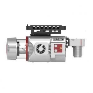
High safety 4.5kg range 1350m@60% multi platform UAV Mapping System ARS-1000L with 15mm@150m accuracy
Base on Riegl LiDAR, the UAV Mapping System ARS-1000L is developed and built by Hi-Cloud. It is a highly integrated system with modules of high-precision laser, high-definition camera, GPS, MEMS inertial navigation and storage control unit. With the advantages of strong performance, light volume, convenient installation and simple operation, it has been recognized by the majority of users and widely used in emergency mapping, topographic mapping, power line inspection, highway survey, coastal reef survey, excavation and filling volume calculation, archaeological survey and mapping and other fields.
Specifications of UAV Mapping System ARS-1000L
1. System performance
| Indicator | Parameter |
| Absolute Accuracy | horizontal <5cm vertical <5cm |
| Weight | 4.5kg |
| Storage | 1TB SSD |
| Input Voltage | 20~30V |
| Power Consumption | <75W |
| Operation Temperature | -10℃~+40℃ |
| Storage Environment | -20℃~+50℃ Humidity < 85% |
| Laser Class | Class1 (eye safe) |
| Indicator | Parameter |
| Maximum Measurement Range | 1350m @60% |
| Minimum Measurement Range | 5m |
| Range Accuracy | 15mm @150m |
| Repetition Accuracy | 10mm @150m |
| Max. Effective Point Frequency | 750000 points/s |
| Laser Gear for Adjustment | 6 levels |
| Maximum number of received echoes | 4~15 |
| FoV(selectable) | 0~330° 60°~90°airborne mode |
| Scan Frequency(selectable) | 10~200 scans/s |
| Angular Resolution | 0.001° |
| Indicator | Parameter |
| Position Accuracy(post-processing) | Horizontal 0.01m Elevation 0.02m |
| Orientation Accuracy(post-processing) | Heading 0.010° Pitch/Roll 0.005° |
| Indicator | Parameter |
| Camera Resolution | ≥42.4MP |
| Camera Weight | <500g |
Practical application project of UAV Mapping System ARS-1000L
Wind farm survey in mountain area
Overview
The survey area is mainly mountainous terrain. The average elevation in the wind farm survey area is high, and the altitude drop in some areas of the measurement area is over 300 meters. The whole wind farm covers an area of about 12 square kilometers. The vegetation is subtropical evergreen broad-leaved forest, with large vegetation coverage rate and various types.
Difficulties
The terrain of the survey area is complex, the altitude difference is large, the traffic is inconvenient, the climate environment is bad. There are several wind turbines with a height of more than 100 meters in the survey area, so it is difficult to design the route. The line of sight is blocked seriously, and it is difficult to locate the take-off point.
Solution
The project adopts ARS-1000L airborne laser measurement system. Three takeoff and landing points are selected in the whole survey area for a total of seven sorties.


